
Keizer Neighbors Around One Address
For a Keizer address, the strongest starting point is the Marion County parcel map and the selected property record it leads to. They can establish that parcels are adjacent on the map and describe fields attached to a selected parcel. They do not produce a verified household list, a complete resident roster, or a one-click radius result. The City Archive adds a different layer: public civic documents that can place a street or project in local meeting history. Historic directories can add a dated printed association, but they cannot be read as a statement about present neighbors.
| Source | What it can show about a block | Access and limit |
|---|---|---|
| Marion Assessor GIS map | Parcel boundaries, situs components, account or taxlot, and selected popup fields | Public manual pan and click. No verified buffer, radius, or public export. |
| Marion Assessor portal | Fields for a selected property account | Known address, account, taxlot, or subdivision only. No streetwide or ZIP search. |
| Keizer City Archive | Public agendas, minutes, newsletters, and project references | Keyword and date research. It is not a member or contact roster. |
| Salem historic directories | Dated printed address or street associations | Collection and edition dependent. Do not infer a current connection. |
| Oregon voter systems | Structured address fields in a formal records context | My Vote is self-service and CAPTCHA-gated. Confidentiality rules apply. |
| Survey and plat material | Legal and spatial relation of lots, roads, and subdivisions | Map context, not a person list. The Survey Office does not interpret maps for a requester. |
Owners, occupants, mailing recipients, and people mentioned in public meeting files are not interchangeable categories. A parcel boundary shows land. A parcel owner field is a dated property-record field. A neighborhood document records civic activity. Keeping those labels intact avoids overstating what the material says about Keizer neighbors.
Keizer Neighbors: Parcels Are Not a Neighbor List
The County method is map-first. Enter a known situs address, taxlot, or account, open the returned parcel, then pan and click contiguous or nearby parcels one at a time. The Assessor's Property Records map includes zoom, home, location, layer, and parcel-click controls. Its attribute table has page-size settings, but the configuration reviewed did not expose a public buffer-radius control or public export. Describe the result as map-adjacent parcels reviewed on a stated date.
That wording matters. The map can show a parcel's taxlot, account, address components, transfer or assessment fields, and map links after selection. It does not tell who is physically present, identify every household member, or supply a complete block result. If a source field is absent, the responsible conclusion is simply that it was not published or not verified.
Note: A manually reviewed group of nearby parcels is a map observation, not a roster of Keizer neighbors.
Trace Keizer Neighbors on a Block by Parcel
A block question can be kept factual by separating the address search from the map review. Start with the exact address as it appears in the source. The County GIS treats its selected parcel as the unit of review, which makes the result easier to date and verify later. This process is for the immediate mapped area. It does not replace the full named-street record chain.
- Preserve the exact street number, direction, street type, unit, locality, and date from the source in hand.
- Use the County GIS with the situs address, taxlot number, account number, or address or place locator to open the matching parcel.
- Record the selected parcel's account and taxlot, then pan and click each contiguous or nearby parcel needed for the narrow map question.
- Label each observation as a selected parcel or map-adjacent parcel, with the map retrieval date and any relevant boundary layer.
- For a broader named-street record sequence, switch to the Keizer address directory rather than treating this small map review as the whole street.
The County parcels are the anchor. A later historic directory, survey, or public archive file should be added only with its own date and source type. That prevents a current map record from being blended with an older civic reference.
Keep Keizer Neighbor Parcel Keys Separate
Small address differences can point to different parcels. Before comparing results, check the street direction and type, unit, city, state, and postal fields returned by the map. The Assessor uses Account Number, Map Tax Lot, Situs Address, and Subdivision as its four visible categories. The GIS labels the parcel key as Taxlot Number and Account Number. A legal description in a deed or survey may identify the same land without a modern street address, so it should be matched only through County source fields.
- Situs address
- The physical location shown for a parcel in the property record. It is distinct from a mailing field.
- Account number
- The Assessor's property-account identifier. It is useful for returning to the same selected record.
- Taxlot
- The County parcel identifier used to connect mapped land to the assessment record.
- Plat
- A recorded map showing a subdivision or related legal layout. It provides spatial context, not a household list.
When the question is a boundary, road, subdivision, or plat relationship, the Marion County Survey research guide directs users back to GIS, address, taxlot, and advanced map-selection methods. It also notes that apostrophes may not search well. The Surveyor's Office library provides maps but does not interpret them for the requester.
Keizer Neighbors Archive Files Add Block History
The Keizer City Archive is the verified community-document route for a block project, public meeting topic, or civic timeline. Its search interface supports keywords, an archive selector, a time-period selector, and start and end dates. Search the exact street name, then repeat without a directional suffix if needed. A street number plus a street stem, a neighborhood name, or a City project term can also help find a dated document. Read each result in context and retain the document date.
The City Archive search is the source for the public neighborhood-document view shown here.
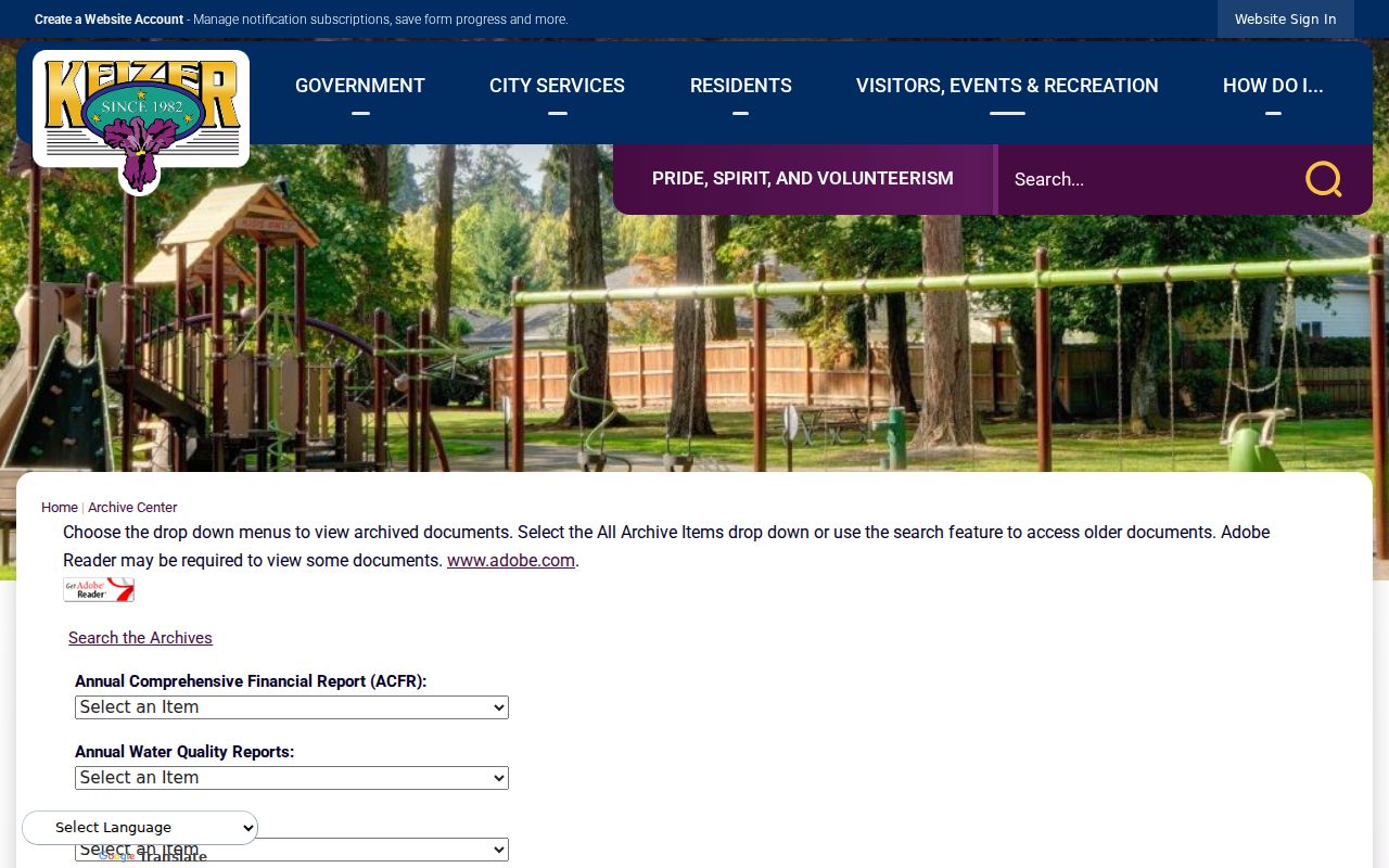
The archive image supports civic-history research, not an attempt to identify a current neighborhood membership. It can help date a public project, meeting, or agency contact around a Keizer block, while the parcel map remains the right source for the mapped property context.
Keizer Neighborhood Documents, Not Rosters
The City Archive contains five named neighborhood-association groupings: GNEKNA, Greater Gubser, Northwest Keizer, Southeast Keizer, and West Keizer. These are local civic-history collections. They can be searched for public agendas, minutes, newsletters, or project references by date, street, or topic. The research did not verify an official umbrella-member directory, an HOA contact roster, a congregation roster, a block-watch roster, or a civic-club roster. Do not fill those gaps with an unverified list.
| City Archive grouping | Supported research use | Limit |
|---|---|---|
| GNEKNA | Search public neighborhood documents by project, street, or date. | Not a current member or contact list. |
| Greater Gubser | Search public neighborhood documents by project, street, or date. | Not a current member or contact list. |
| Northwest Keizer | Search public neighborhood documents by project, street, or date. | Not a current member or contact list. |
| Southeast Keizer | Search public neighborhood documents by project, street, or date. | Not a current member or contact list. |
| West Keizer | Search public neighborhood documents by project, street, or date. | Not a current member or contact list. |
The groups are useful because they preserve local chronology. A meeting-file reference may explain when a public project was discussed, not who lives nearby now. For City-created material not present in the archive, use the City's official public-records request route with a specific street, project, record type, and date range rather than requesting a broad profile of people.
Note: Date, document type, and archive grouping should travel with every City Archive finding about a Keizer block.
Keizer Neighbor Questions Need Sources
Official sources identify their custodian, search route, and limits. That makes them better suited to a narrow block question than commercial neighbor-lookup tools, which are not a verified Keizer records source. The comparison is not a reason to assemble a personal dossier. It is a reminder to use the right record for the claim, retain its date, and leave an uncertain field unverified.
| Question | Official Keizer-area route | Commercial neighbor-tool category |
|---|---|---|
| Which parcels touch or sit near an address? | County GIS manual map selection, dated at retrieval. | Not a verified Keizer parcel source. |
| What does the selected property record say? | Marion Assessor result for the selected account or taxlot. | Not a substitute for the County record or its date. |
| What public civic material mentions a street or project? | Keizer City Archive keyword and date search. | Not a substitute for a dated City document. |
| What election route is available? | My Vote for self-service or the State's formal voter-list process. | Cannot override Oregon confidentiality controls. |
Oregon's My Vote route is for a person's own registration and was CAPTCHA-gated on the research date. The separate State voter-list request process has fees, timing, field restrictions, and confidentiality rules. It is not a live block browser. The voter-file specification's address components do not establish current presence, ownership, or household composition.
Protect Keizer Neighbors and Addresses
Oregon voter confidentiality and the Address Confidentiality Program require suppression, not inference. A qualifying voter may seek confidentiality through the County Clerk using SEL 550, and the Oregon Department of Justice Address Confidentiality Program is a separate protective service. Never use a historic directory, parcel mailing string, archive mention, or missing result to reconstruct a potentially protected location. A parcel boundary also does not identify every household member, while utility and delivery-customer data are not public adjacency layers.
Oregon Public Records Law includes exemptions and conditional disclosure rules. If a custodian withholds or redacts a record, ask for the legal basis and enough information to understand the category, not the protected detail itself. A correction concern belongs first with the named custodian and should include the record identifier and a dated screenshot. The Secretary of State confidentiality guidance is the official starting point for voter-address protection.
Lawful use. Use Keizer neighbor research for personal, lawful civic or property curiosity, and do not use a partial record to watch, threaten, stalk, harass, or harm anyone. Oregon stalking and harassment provisions include ORS 163.732 and ORS 166.065.